📍 How to reach us
We are located on the hills of Gallina, 240 meters above sea level and just 8 km from the historic center of Reggio Calabria.
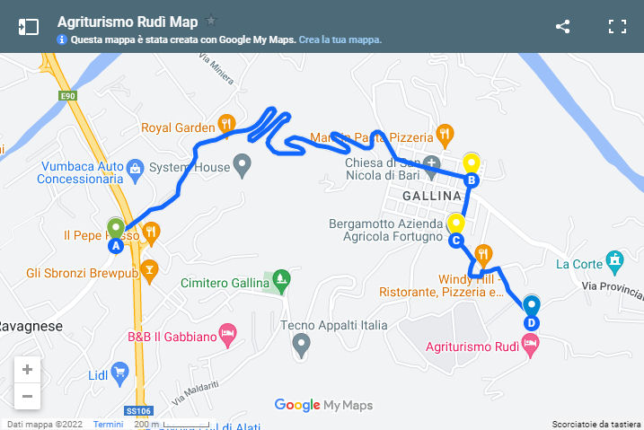
🚗 By Car (Watch out for GPS!)
⚠️ Important note for those arriving from the North (direction Taranto):
The navigator may give you incorrect directions at the ARANGEA - GALLINA junction.
- What to do: Once you have crossed the motorway junction bridge, proceed straight towards Gallina.
- What NOT to do: Do not turn right, even if advised by GPS.
📍 Open the Map with the correct route on Google Maps
GPS coordinates for your navigator:
- Decimal format: 38.08070 lat | 15.68365 lng
- DMS format: N 38°04'51.5" | E 15°41'00.9"
🚌 Public Transport (ATAM Reggio Calabria)
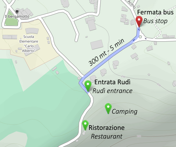
- Bus stop: "Via Gallina-Armo, 29" (just 300 meters / 5 min walk from the agriturismo).
- Tickets: Can be purchased at tobacconists, on board (with a surcharge) or via app.